The Importance of Data Localization in the Inspection Business—And How Inspector 3.0 Can Help
Inspections in any industry serve a single, critical purpose: identifying defects in assets. Whether it's a boiler, a pipeline, or a storage tank, the goal is to find issues before they escalate into major problems.
When inspectors conduct manual inspections, they often have a clear view of the defect because they are physically present at the location. However, with the rise of remote visual inspection tools like the Elios 2, the challenge of accurately locating defects has become more complex.
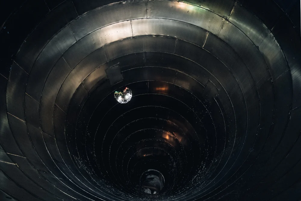
Indoor drones like the Elios 2 offer a safer and more efficient way to inspect hard-to-reach areas, but without GPS, determining the exact location of a defect becomes a challenge. When reviewing footage from an indoor drone, how can you be sure where exactly the defect is located within the asset?
Sometimes the answer is obvious, but other times, it requires a combination of techniques, such as using barometric data, blueprints, maps, and reference points from the video. Even with all these tools, pinpointing the exact location can still be difficult.
For instance, one inspector shared that he often combines multiple data sources—like barometric measurements, maps, and video references—to locate a defect after using the Elios 2. Despite this effort, accuracy remains a challenge without proper localization tools.
DATA LOCALIZATION = BIG SAVINGS
Knowing the precise location of a defect can save time, money, and resources. If a repair requires entering an asset by cutting a hole, digging, or other labor-intensive steps, getting the location wrong can lead to wasted effort and costly delays.
Incorrect localization not only increases repair time but also extends downtime, which can result in significant revenue loss for companies. It also affects cost efficiency, especially when it comes to scaffolding. With accurate data, scaffolding can be placed exactly where needed, avoiding unnecessary work and expenses.
DATA LOCALIZATION ALSO MEANS HAPPY CUSTOMERS
Customers expect detailed reports showing the exact location of each defect. If they don’t receive this information, they may feel dissatisfied, even if the inspection was thorough.
Moreover, data localization helps different teams—inspectors, maintenance workers, scaffolders, operators, and managers—communicate more effectively. A 3D map can bridge the gap between technical and non-technical personnel, ensuring everyone understands the issue and knows what needs to be done.
For example, scaffolders who aren't familiar with the site can use a 3D map to determine where to place equipment. Operators can point to a specific area on the map and direct repair crews accordingly. This level of clarity improves collaboration and ensures that work is done efficiently and accurately.
HOW INSPECTOR 3.0 SOLVES THE DATA LOCALIZATION PROBLEM
Data localization is essential for modern inspections, and now, Flyability’s new software, Inspector 3.0, offers a powerful solution. It allows inspectors to create a 3D map of the inspected asset, making it easy to locate and visualize defects.
Inspector 3.0 is designed specifically for the Elios 2, enabling users to turn their visual data into a 3D model of the asset. This makes it easy to identify and locate defects quickly and accurately.
Key features include:
- Marking Points of Interest (POIs) during the flight using the remote controller.
- Creating a sparse 3D map after the mission to visualize where the defects are located.
- Generating maps in under 20–50 minutes, allowing real-time feedback to clients.
“Inspector 3.0 solves the problem of not knowing where the damage is,†says Simon Kumm from InspecDrone. “Now we can show our clients exactly where the issue is.â€
With Inspector 3.0, the process is simple: fly, mark, and map. The result is a clear, visual representation of the asset and its defects, making communication with clients and teams much easier.
Whether you're looking to improve efficiency, reduce costs, or enhance customer satisfaction, Inspector 3.0 provides the tools you need to localize your data and make informed decisions. Learn more about how Inspector 3.0 can transform your inspection process today.
Ram Packer,Ordinary Ram Packer,Assembly Ram Packer,Shearing Ram Side Seal
Sichuan Xinwei Rubber Co., Ltd , https://www.boprubber.com